Posti da Visitare (6)

Posti da Visitare

Ostuni - La città bianca

«Ostuni è la città panoramica per eccellenza, ogni casa è un belvedere, ogni trattoria è della Bellavista, ad ogni finestra v'è un poeta che guarda nella pianura sottostante gli ulivi che cangian colore a tutti i venti […] A Ostuni le case sono bianche, di latte e calce, sono bianche fino a far male agli occhi, sono candidi i muri, le finestre, le porte, le scale, tutto è inverosimilmente bianco. […] A Ostuni si va per capire cosa vuol dire stare al riparo dal sole […] per non desiderare più romanzi, per non pensare più a viaggi lontani, qui c'è il fascino di tutte le città dei mari del Sud, qui c'è l'equatore a portata di mano.» Ostuni sorge su tre colli ad un'altezza di 218 metri s.l.m.. È situato a 7,5 km dalla costa adriatica. La Murgia, sui quali colli sud orientali si trova la città, è una zona carsica costituita essenzialmente da calcari cretacei. È perciò una zona piuttosto arida e priva di corsi d'acqua: al loro posto le cosiddette "lame", letti torrentizi a carattere stagionale, dai solchi poco profondi e dalle pareti ripide. Altra caratteristica geologica del territorio sono le "gravine", dei burroni carsici. Le attività economiche più importanti sono il turismo e l'agricoltura (soprattutto ulivi e viti). Importanti e numerose le presenze di strutture dette "masserie", ovvero antiche fattorie fortificate presenti sia nella selva ostunese che nella marina, dove si svolgeva l'attività agricola dei grossi proprietari terrieri. Dal secondo dopoguerra a ora, accanto allo sviluppo dell'agricoltura e dell'industria di trasformazione ad essa correlata (olio di oliva, mandorle, vino), la città è diventata una rinomata meta turistica, riuscendo a valorizzare i suoi beni culturali, storici e architettonici. Numerosi villaggi turistici, come ad esempio Rosa Marina, di rilevanza internazionale, sono sorti sul litorale, uno dei più puliti della costa pugliese. Nel 2006 si è istituito sulla costa che confina con il comune di Fasano il Parco naturale regionale Dune costiere da Torre Canne a Torre San Leonardo, area protetta di elevato interesse naturalistico e paesaggistico. La caratteristica più peculiare del centro storico, che così tanto affascinava i turisti, era l'imbiancatura a calce delle case fino ai tetti. L'uso, attestato sin dal Medioevo, deriva, oltre che dalla facile reperibilità della calce come materia prima, dalla necessità di assicurare alle viuzze e agli ambienti ristretti di impianto medievale una maggiore luminosità, data dalla luce sia diretta che riflessa. Come già detto, questo costume ha rivestito anche un ruolo importante storicamente nel XVII secolo, quando l'imbiancatura a calce fu l'unico modo per evitare che la peste dilagasse nella cittadina ed il contagio aumentasse sino a portarne la distruzione. Questa pratica, oggi in declino tanto che il sindaco ha dovuto emanare un'ordinanza per farla tornare in auge[20], fece sì che Ostuni fosse denominata Città Bianca o Città Presepe, ed era una caratteristica che la rendeva riconoscibile e indimenticabile ai visitatori. «Ostuni is the panoramic city par excellence, every house is a belvedere, every trattoria belongs to the Bellavista, at every window there is a poet who looks at the plain below the olive trees that change color in all the winds [...] In Ostuni the houses they are white, of milk and lime, they are white to the point of hurting the eyes, the walls, the windows, the doors, the stairs are white, everything is incredibly white. [...] One goes to Ostuni to understand what it means to be sheltered from the sun [...] to stop desiring novels, to stop thinking about distant journeys, here is the charm of all the cities of the South Seas, here the equator is close at hand.” Ostuni stands on three hills at a height of 218 meters above sea level. It is located 7.5 km from the Adriatic coast. The Murgia, on which the city is located on the south-eastern hills, is a karst area essentially made up of Cretaceous limestone. It is therefore a rather arid area with no watercourses: in their place are the so-called "lame", torrential beds of a seasonal nature, with shallow furrows and steep walls. Another geological feature of the area are the "ravines", karst ravines. The most important economic activities are tourism and agriculture (especially olive trees and vines). The presence of structures called "masserie" is important and numerous, i.e. ancient fortified farms present both in the Ostuni forest and in the marina, where the agricultural activity of the large landowners took place. From the second post-war period to now, alongside the development of agriculture and the related processing industry (olive oil, almonds, wine), the city has become a renowned tourist destination, managing to enhance its cultural, historical and architectural. Numerous tourist villages, such as Rosa Marina, of international importance, have sprung up on the coast, one of the cleanest on the Apulian coast. In 2006, the Coastal Dune Regional Park from Torre Canne to Torre San Leonardo was established on the coast bordering the municipality of Fasano, a protected area of ​​great naturalistic and landscape interest. The most distinctive feature of the old town, which fascinated tourists so much, was the whitewashing of the houses up to the roofs. The use, attested since the Middle Ages, derives not only from the easy availability of lime as a raw material, but also from the need to ensure greater brightness to the alleys and narrow rooms of medieval layout, given by both direct and reflected light. As already mentioned, this custom also played an important historical role in the seventeenth century, when whitewashing was the only way to prevent the plague from spreading in the town and the contagion increasing until it was destroyed. This practice, now in decline so much that the mayor had to issue an ordinance to bring it back into vogue [20], meant that Ostuni was called the White City or Crib City, and it was a feature that made it recognizable and unforgettable for visitors.
Read more...

Santuario di Maria Santissima di Belvedere

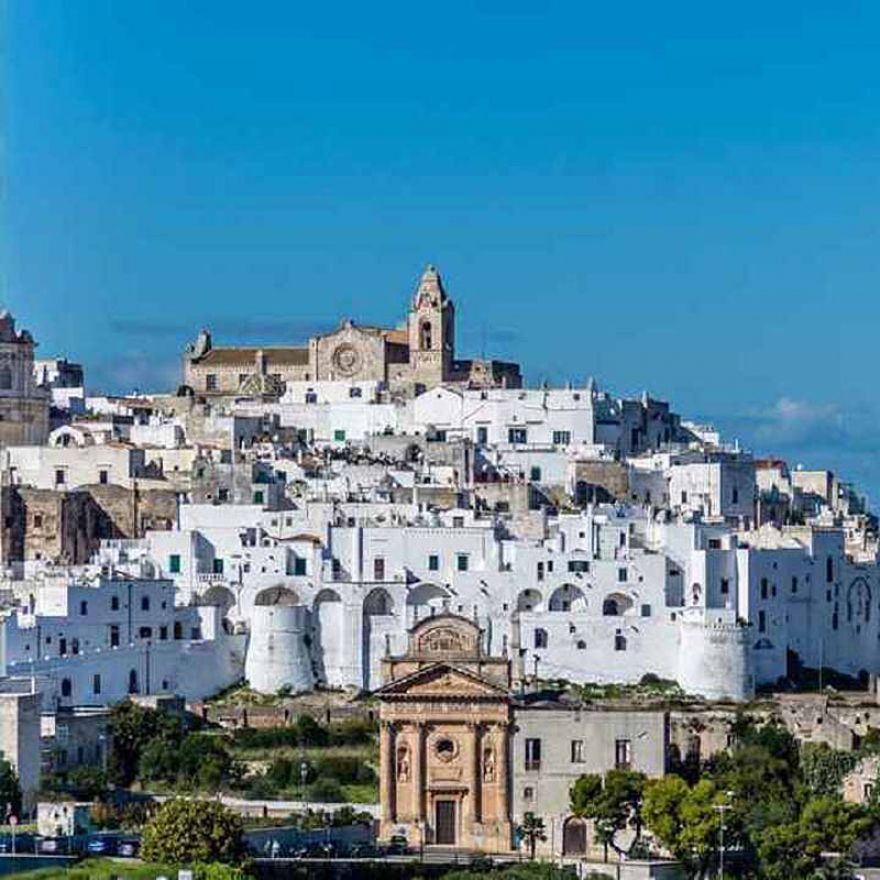
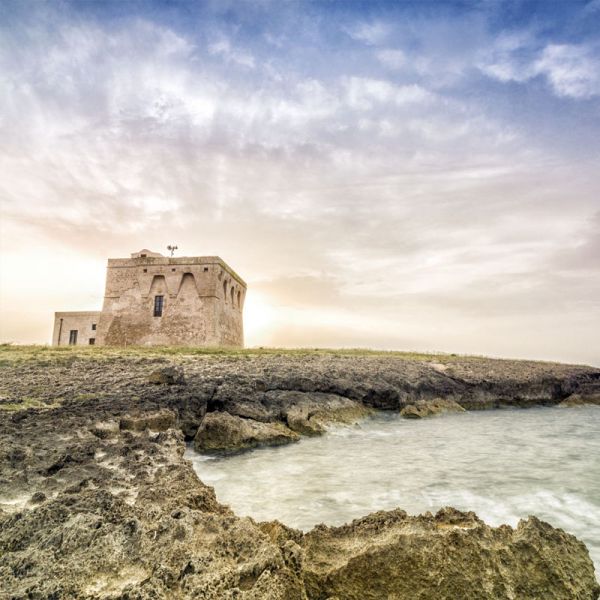
Il santuario di Maria Santissima di Belvedere è dedicato all'omonima Madonna, col titolo di "Belvedere". Il santuario è situato su un'altura a circa 100 metri s.l.m, in una zona dove il paesaggio si staglia verso una piana di ulivi secolari fino ad arrivare al mare, per questo compare il nome "Belvedere". Il santuario si trova a 4 km a nord-est da Carovigno. All'interno del santuario, vi sono due grotte, poste a due differenti livelli. Entrambe sono collegate all'interno della chiesa tramite una larga gradinata, la "scala santa", formata in tutto da 47 gradini. Nei due livelli vi sono vari affreschi che ritraggono principalmente la Madonna di Belvedere. Il santuario è meta di pellegrinaggio in vari periodi dell'anno, in particolare nella settimana dopo Pasqua, quando Carovigno è nel pieno delle festività in onore di Maria Santissima di Belvedere, con il tradizionale rito quasi millenario della 'Nzegna, che si svolge il lunedì e martedì dopo Pasqua in paese e il sabato sempre dopo Pasqua nel Santuario di Belvedere. STORIA Il santuario è stato costruito su due piani di grotte, rinvenute secondo la leggenda, da un pastore e un signore di Conversano, mentre essi cercavano il primo il suo vitellino e il secondo l'immagine della Madonna di Belvedere apparsa in sogno giorni prima. Questa leggenda, ha portato la cittadina di Carovigno, a una forte devozione per la Madonna di Belvedere, con vari pellegrinaggi durante alcuni periodi dell'anno e in special modo, con il rito della 'Nzegna, quasi millenario. Altare della prima cripta. Una struttura precedente a quella attuale, venne commissionata nel 1501, dal nobile napoletano Pirro Loffreda, che fece costruire anche un altare di tipo basilicale, nel primo piano della grotta, dove nel 1525 venne sepolta la moglie Laudomia Alagno. L'altare, venne costruito dall'ostunese Giovanni Lombardo, uno scultore e architetto. L'altare presenta un baldacchino addossato alla parete, con delle sottili colonne sormontate da dei capitelli ed una complessa trabeazione. Planimetria del Santuario, Vista longitudinale delle grotte e frontale del secondo piano e Fregio dell'altare nel primo piano della grotta. Nel 1875, il Santuario ricevette la forma attuale, a seguito dei lavori di restauro e ampliamento da parte del Commendatore Alfredo Dentice di Frasso. La Chiesa della grotta, si rifà in parte alle prime basiliche cristiane. È provvista di una sola navata. L'equilibrio delle proporzioni tra altezza, lunghezza e larghezza, riporta a un'architettura rinascimentale. Il pavimento in maiolica napoletana dell'Ottocento, rappresenta i simboli della croce greca e quella latina, che riporta quindi alle origini di questo luogo e anche dell'inizio della ‘Nzegna. GROTTA Le grotte sono di tipo carsico, tipiche del luogo e si dividono in due livelli o cripte: Cripta superiore e Cripta inferiore. Queste due grotte sono collegate tra di loro e con la Chiesa, attraverso una larga gradinata, formata da 47 gradini in tutto. Durante la scesa di questa scala, secondo la tradizione, bisogna recitare una preghiera per ogni gradino, per far sì che, nell'arrivo alla cripta inferiore dinanzi all'immagine della Madonna di Belvedere, ci sia stata una “purificazione dell'anima”. Lungo la breve scesa della prima scalinata, si trovano sulla destra una statuetta della Madonna di Finibus Terrae, mentre sulla sinistra viene conservato il quadro della Madonna di Belvedere. La prima cripta superiore è grande 9x7 metri e alta 4. In questo piano, vi è un altare con al centro un affresco ritraente la Madonna con Gesù tra le mani. La seconda scalinata è più stretta e lunga rispetto alla prima. Nella cripta inferiore vi è principalmente un altare con al centro un dipinto della Madonna di Belvedere. Accanto l'altare, vi è un altro dipinto della Madonna di Belvedere più grande rispetto all'altro. TRADIZIONE - LA 'NZEGNA ED IL SABATO DI BELVEDERE La 'Nzegna è la più antica tradizione religiosa legata allo sbandieramento in Italia. Questa tradizione porta anche alla nascita del luogo e delle grotte come luogo di culto legato alla Madonna di Belvedere. La 'Nzegna si svolge il lunedì e martedì dopo Pasqua a Carovigno, mentre il sabato nel Santuario. Quest'ultimo giorno prende vari nomi tra cui "Sabato di Belvedere", "Ottava di Belvedere", ma anche "la Pasquetta dei carovignesi". Battitura della 'Nzegna davanti al Santuario di Belvedere Secondo la leggenda, ambientata ai tempi di Goffredo III di Montescaglioso quando era conte di Brindisi (XI-XII secolo d.C., una notte un paralitico di Conversano, sognò la Madonna che lo invitava a trovarla a Carovigno nel Santuario di Belvedere. L'uomo arrivato in paese con alcuni suoi aiutanti, iniziò a chiedere notizie riguardo al Santuario, ma gli venne indicata solo una contrada con il nome di "Belvedere". Arrivato lì, durante le ricerche, venne udito un lamento da parte di un pastore, disperato per aver perso il miglior vitello che possedeva. Così insieme, iniziarono a ricercare sia l'animale che il dipinto della Vergine. Dopo varie ricerche, si udii un lamento proveniente dal sottosuolo, dietro un mucchio di arbusti ed erbacce. Il pastore tagliò le piante e trovò una grotta. Scese ma non trovò niente, poi scorse un altro buco che portava più in profondità. Sceso nella seconda grotta trovò il suo vitellino genuflesso dinanzi a un'immagine di una Madonna. Il paralitico appena seppe la notizia, volle vedere di persona se l'immagine corrispondeva a quella sognata. Appena la vide iniziò a pregare e improvvisamente tutti i mali che aveva scomparvero. Il pastore per la gioia del ritrovamento e del miracolo, prese un bastone al quale attaccò un fazzoletto multicolore che, iniziò a sventolare e tirare in aria, facendosi notare anche dalla gente vicina e facendo arrivare la voce della scoperta e del miracolo fino al paese. Venne così coniato il termine "Battitura della 'Nzegna", che ancora oggi a distanza di secoli si esegue ogni anno il lunedì, martedì e sabato dopo Pasqua. Il conversanese acquistò il vitello che affidò a una taverna. L'animale venne addobbato e lasciato libero nel pascolare e venne chiamato dai carovignesi "la vaccaredda di la Madonna" (il vitellino della Madonna). Anni dopo venne ucciso in contemporanea con i giorni della 'Nzegna. Venne così preparato un grande banchetto a cui poteva partecipare tutta la popolazione povera del paese. L'evento venne organizzato fino all'inizio del '900, interrotto poi per motivi di ordine pubblico. Da allora l'ultimo giorno della 'Nzegna prese i vari nomi che oggi si attribuiscono e inoltre, dopo il battimento della 'Nzegna, la popolazione si riversa nelle campagne a festeggiare tra prodotti tipici locali e musiche e balli tradizionali. The sanctuary of Maria Santissima di Belvedere is dedicated to the homonymous Madonna, with the title of "Belvedere". The sanctuary is located on a hill about 100 meters above sea level, in an area where the landscape stands out towards a plain of centuries-old olive trees up to the sea, which is why the name "Belvedere" appears. The sanctuary is located 4 km north-east of Carovigno. Inside the sanctuary, there are two caves, placed at two different levels. Both are connected inside the church by a large flight of steps, the "holy staircase", made up of 47 steps in all. On the two levels there are various frescoes that mainly portray the Madonna di Belvedere. The shrine is a pilgrimage destination at various times of the year, especially in the week after Easter, when Carovigno is in the midst of the festivities in honor of Maria Santissima di Belvedere, with the almost millennial traditional rite of 'Nzegna, which takes place on Monday and Tuesday after Easter in the village and Saturday always after Easter in the Sanctuary of Belvedere. HISTORY The sanctuary was built on two floors of caves, found according to legend by a shepherd and a gentleman from Conversano, while they were looking for his calf and the second for the image of the Madonna di Belvedere that had appeared in a dream days before. This legend has led the town of Carovigno to a strong devotion to the Madonna di Belvedere, with various pilgrimages during certain periods of the year and especially, with the almost millenary rite of 'Nzegna. Altar of the first crypt. A previous structure to the current one was commissioned in 1501 by the Neapolitan nobleman Pirro Loffreda, who also had a basilica-type altar built on the first floor of the cave, where his wife Laudomia Alagno was buried in 1525. The altar was built by Giovanni Lombardo from Ostuni, a sculptor and architect. The altar has a canopy leaning against the wall, with thin columns surmounted by capitals and a complex trabeation. Plan of the Sanctuary, Longitudinal view of the caves and frontal view of the second floor and Frieze of the altar on the first floor of the cave. In 1875, the Sanctuary received its current form, following the restoration and expansion works by Commendatore Alfredo Dentice di Frasso. The Church of the cave, partly refers to the first Christian basilicas. It has a single nave. The balance of proportions between height, length and width brings us back to Renaissance architecture. The 19th century Neapolitan majolica floor represents the symbols of the Greek and Latin cross, which therefore takes us back to the origins of this place and also to the beginning of the 'Nzegna. CAVES The caves are of the karst type, typical of the place and are divided into two levels or crypts: Upper Crypt and Lower Crypt. These two caves are connected to each other and to the Church, through a large flight of steps, made up of 47 steps in all. During the descent of this staircase, according to tradition, a prayer must be recited for each step, to ensure that, upon arrival at the lower crypt in front of the image of the Madonna di Belvedere, there has been a "purification of the soul". Along the short descent of the first stairway, a small statue of the Madonna di Finibus Terrae can be found on the right, while the painting of the Madonna di Belvedere is kept on the left. The first upper crypt is 9x7 meters large and 4 meters high. On this floor, there is an altar with a fresco portraying the Madonna with Jesus in her hands in the centre. The second stairway is narrower and longer than the first. In the lower crypt there is mainly an altar with a painting of the Madonna di Belvedere in the centre. Next to the altar, there is another painting of the Madonna di Belvedere larger than the other. TRADITIONS La 'Nzegna and Belvedere Saturday The 'Nzegna is the oldest religious tradition linked to flag waving in Italy. This tradition also leads to the birth of the place and the caves as a place of worship linked to the Madonna di Belvedere. La 'Nzegna takes place on Monday and Tuesday after Easter in Carovigno, while on Saturday in the Sanctuary. This last day takes various names including "Saturday of Belvedere", "Eighth of Belvedere", but also "the Pasquetta dei carovignesi". According to the legend, set in the times of Goffredo III of Montescaglioso when he was count of Brindisi (11th-12th century AD), one night a paralytic from Conversano dreamed of the Madonna inviting him to find her in Carovigno in the Sanctuary of Belvedere. The man arrived in the village with some of his helpers, he began to ask for news about the Sanctuary, but only one district was indicated to him with the name of "Belvedere".Arrived there, during the search, a lament was heard from a shepherd, desperate for having lost the best calf he owned. So together, they began to search for both the animal and the painting of the Virgin. After much searching, a moan was heard coming from underground, behind a pile of shrubs and weeds. The shepherd cut down the plants and found a cave. He went down but found nothing, then he saw another hole that led deeper. Going down into the second cave he found his little calf kneeling in front of an image of a Madonna. The paralytic just sep for the news, he wanted to see for himself if the image corresponded to the dreamed one. As soon as he saw her he began to pray and suddenly all the evils he had disappeared. For the joy of the discovery and the miracle, the shepherd took a stick to which he attached a multicolored handkerchief which he began to wave and throw in the air, making himself noticed even by the nearby people and making the voice of the discovery and miracle reach the village. Thus the term "Battitura della 'Nzegna" was coined, which still today after centuries is carried out every year on Monday, Tuesday and Saturday after Easter. The Conversanese bought the veal which he entrusted to a tavern. The animal was decorated and left free to graze and was called by the inhabitants of Carovigne "la vaccaredda di la Madonna" (the little calf of the Madonna). Years later he was killed at the same time as the days of 'Nzegna. Thus a great banquet was prepared in which all the poor population of the country could participate. The event was organized until the beginning of the 1900s, then interrupted for reasons of public order. Since then, the last day of the 'Nzegna took the various names that are attributed today and furthermore, after the beating of the 'Nzegna, the population pours into the countryside to celebrate among typical local products and traditional music and dances.
Read more...

La Valle d'Itria

GEOGRAFIA La Valle d'Itria coincide con la parte meridionale dell'altopiano delle Murge. Nota anche come "Valle dei Trulli", si estende tra le province di Bari, Taranto e Brindisi e, oltre ai comuni di Locorotondo, Martina Franca e Cisternino, piccole porzioni della Valle d'Itria ricadono anche nei comuni di Alberobello, Ostuni e Ceglie Messapica. Martina Franca è il comune con la massima altitudine (431 metri slm) e maggiormente popolato (circa 50 000 ab.) della Valle d'Itria, Il capoluogo di provincia più vicino e meglio collegato è Taranto, distante non più di 45 chilometri da ogni comune. FLORA E FAUNA La flora si compone di tratti di bosco e di macchia mediterranea, alternati a numerosi vigneti da cui si ricavano vini bianchi tra i quali il Locorotondo DOC e il Martina Franca DOC, e oliveti secolari dai quali si produce olio di oliva extravergine. Si possono osservare aree naturali protette come il Bosco delle Pianelle di Martina Franca e la Selva di Fasano. La fauna è caratterizzata dalla presenza di, volpi, ricci, pettirossi, occasionalmente falchi e diversi rapaci notturni (civetta, gufo, assiolo e barbagianni)[2]. Presenti anche cinghiali, istrici, gatti selvatici, scoiattoli e daini. Numerose le specie di uccelli migratori di passaggio quali le cicogne bianche, le gru, i germani reali, storni e tordi,quest'ultimi molto numerosi nel Monte Castel Pagano sulla strada tra Cisternino e Martina Franca. TURISMO Attualmente la Valle d'Itria è una delle zone d'Italia a maggior frequentazione turistica. Le bellezze naturali, architettoniche e paesaggistiche di questa porzione della Murgia dei Trulli ne fanno una delle mete principali del turismo internazionale. Tutto questo giustifica l'alta presenza di strutture ricettive e gastronomiche, nonché di numerosi eventi durante l'anno. Le maggiori attrattive turistiche sono: - I centri storici, caratterizzati da vicoli e stradine ingarbugliate e pavimentate con le tipiche chianche, dalle case imbiancate a calce e dai caratteristici balconi fioriti, dalle chiese e dai monumenti di varie epoche. Unico nel suo genere è il vasto centro storico di Martina Franca in cui gli elementi tipici dei centri storici itriani si mischiano al Barocco creando un contesto elegante e artistico con grandi capolavori d'arte come la Basilica di San Martino e la relativa collegiata, i porticati e gli archi finemente lavorati. Il piccolo centro storico di Cisternino invece, presenta un aspetto più semplice e rustico ed è inserito tra i 100 borghi più belli d'Italia. Il centro storico di Locorotondo, è caratterizzato, invece, dalle caratteristiche case con il tetto a spiovente coperto con le chiancarelle chiamate cummerse, più diffuse in questo comune rispetto a quelli limitrofi e il "lungomare" ovvero la passeggiata panoramica che si affaccia sulla suggestiva valle. - I grandi agglomerati di Trulli; - Le Masserie; - l'enogastronomia tipica di questa zona. Cibi tipici di tutta la zona sono i taralli, le friselle, le olive, la focaccia, le pettole e i panzerotti. Famose e pregiate sono le carni della valle d'Itria tra cui spiccano gli Gnummareddi, il Capocollo di Martina Franca e le Bombette di carne di maiali allevati nei boschi della valle d’Itria, caratteristiche della zona. I vini DOC sono il Martina Franca e il Locorotondo; - le aree naturali e boschive tra i quali spicca il bosco delle Pianelle di un’area di ca. 1000 ettari sito nel comune di Martina Franca. GEOGRAPHY The Itria Valley coincides with the southern part of the Murge plateau. Also known as "Valle dei Trulli", it extends between the provinces of Bari, Taranto and Brindisi and, in addition to the municipalities of Locorotondo, Martina Franca and Cisternino, small portions of the Itria Valley also fall in the municipalities of Alberobello, Ostuni and Ceglie Messapica. Martina Franca is the municipality with the highest altitude (431 meters above sea level) and most populated (about 50 000 ab.) of the Itria Valley, The nearest provincial capital and best connected is Taranto, not more than 45 kilometers from each municipality. FLORA AND FAUNA The flora consists of stretches of woods and Mediterranean scrub, alternating with many vineyards from which are obtained white wines including Locorotondo DOC and Martina Franca DOC, and secular olive groves from which extra virgin olive oil is produced. You can observe protected natural areas such as the Bosco delle Pianelle di Martina Franca and the Selva di Fasano. The fauna is characterised by the presence of foxes, hedgehogs, robins, occasionally hawks and several nocturnal birds of prey (owls, owls, badgers and barn owls)[2]. There are also wild boars, porcupines, wild cats, squirrels and deer. Numerous migratory birds such as white storks, cranes, mallards, starlings and thrushes, the latter very numerous in Monte Castel Pagano on the road between Cisternino and Martina Franca. TOURISM Currently the Itria Valley is one of the most frequented areas of Italy. The natural, architectural and landscape beauties of this part of the Murgia dei Trulli make it one of the main destinations of international tourism. All this justifies the high presence of accommodation and gastronomic facilities, as well as numerous events throughout the year. The main tourist attractions are: - The historic centres, characterized by narrow streets and narrow streets tangled and paved with the typical chianche, whitewashed houses and characteristic flowered balconies, churches and monuments of various eras. Unique in its kind is the vast historic center of Martina Franca in which the typical elements of the Itrian historical centers are mixed with the Baroque creating an elegant and artistic context with great masterpieces of art such as the Basilica of San Martino and its collegiate, the porches and arches finely worked. The small old town of Cisternino, on the other hand, has a more simple and rustic look and is included among the 100 most beautiful villages in Italy. The historic center of Locorotondo, is characterized, instead, by the characteristic houses with a sloping roof covered with the chiancarelle called cummerse, more widespread in this town than the neighboring ones and the "promenade" or the panoramic walk that overlooks the picturesque valley. - the large agglomerations of Trulli; - Le Masserie; - the typical food and wine of this area. Typical foods of the whole area are taralli, friselle, olives, focaccia, pettole and panzerotti. Famous and valuable are the meats of the Itria valley including the Gnummareddi, the Capocollo of Martina Franca and the Bombette meat of pigs raised in the woods of the Itria valley, characteristics of the area. DOC wines are Martina Franca and Locorotondo; - the natural and wooded areas, among which the Pianelle forest stands out in an area of approx. 1000 hectares in the municipality of Martina Franca
Read more...

Castello Dentice di Frasso di Carovigno

Il castello di Carovigno porta il nome della città su cui fu edificata l'antica Carbina. Come tutti i monumenti fortificati, sulla parte più alta del paese. STORIA Non si conoscono notizie certe sulle sue origini, ma secondo Vincenzo Andriani, il primo nucleo dell'attuale castello, nacque all'interno della cinta muraria durante il periodo Normanno. Su una pergamena antica del 1163, conservata nell'archivio capitolare di Ostuni, si ritrova la denominazione di “Castellum Carvinei”, che consisteva in una sola torre della forma quadrata, posta sul lato di porta Ostuni. Tale torre fu costruita su una galleria sotterranea, adibita prima a prigione e poi a deposito olio. Successivamente con i lavori di restauro, venne affogata per motivi di stabilità e per maggiore precauzione, venne costruita una veranda arcata per puntellare la torre che minacciava di crollare da una parte, dall'altra parte fu addossata una torretta di minori dimensioni. Dalla veranda si poteva accedere alla Chiesa di Sant'Anna, percorrendo un camminamento ricavato sulla porta Ostuni, oggi ostruito. Sulle arcate della veranda, furono scolpite gli stemmi dei feudatari di Carovigno. Il castello è stato ampliato nel tempo, secondo le esigenze dei principi feudali che l'hanno abitata. Oggi ha la forma triangolare (simbolo della perfezione) con la presenza di tre torri situate ai tre vertici: una quadrata, una rotonda e una a mandorla. La torre a Mandorla, molto massiccia, con la punta rivolta verso il mare, detta anche torre a forma di carena di nave, fu costruita nel XV secolo dai Loffredo, principi di quel tempo. Lo scopo della costruzione della torre a mandorla, fu quello di schivare e deviare i colpi di arma da fuoco, lanciati contro di essa per limitare i danni. Nel castello sono presente “le segrete” dei locali sotterranei, che nel tempo hanno avuto diverse funzioni, tra cui prigioni, depositi, cantine, laboratori di falegnameria. STRUTTURA Il castello ha una struttura a forma triangolare, con ai suoi vertici una torre quadrata, una circolare e una a forma di "mandorla". Nel resto della Puglia, ne esistono solo altri due di castelli simili, a Monte Sant'Angelo e a Rocchetta Sant'Antonio. Il castello sorge a ridosso della vecchia cinta muraria a scopo difensivo per il paese. Dal castello è possibile ammirare un panorama che va da Torre Canne fino a Brindisi, ma abbracciando anche la Valle d'Itria, guardando anche altri borghi quali Ceglie Messapica ed Ostuni. Accanto al castello vi è anche la Chiesa di Sant'Anna, collegata attraverso Porta Ostuni, con un passaggio oggi chiuso. LE SEGRETE Nella parte inferiore più antica del castello, sono presenti dei sotterranei, detti anche segrete. Sono scavati nella dura roccia, confluendo in un corridoio principale lungo 17,90 metri, a 4,80 metri di profondità, largo 1,70 metri e alto 2,50 metri. Altre zone vennero chiuse per rendere più stabile la struttura soprastante. Si accedeva ad essi tramite una scala sita nell'atrio fino al 1920, ma anche tramite alcune botole oggi chiuse. Prima del restauro del 1904/1916, i sotterranei erano adibite a prigioni. Ai lati del corridoio sono presenti delle piscine profonde 4 metri, rivestite da blocchi in pietra di Carovigno, tenute senza calce. Dopo il restauro queste zone vennero adibite a deposito dell'olio e a neviere. The castle of Carovigno bears the name of the city on which the ancient Carbina was built. Like all fortified monuments, on the highest part of the country. HISTORY No definite information is known about its origins, but according to Vincenzo Andriani, the first nucleus of the current castle, was born within the walls during the Norman period. On an ancient parchment of 1163, preserved in the chapter archive of Ostuni, we find the name of "Castellum Carvinei", which consisted of a single square tower, located on the side of Ostuni gate. This tower was built on an underground tunnel, used first as a prison and then as an oil depot. Later with the restoration work, it was drowned for reasons of stability and for greater precaution, an arched veranda was built to prop up the tower that threatened to collapse on one side, on the other side was placed against a smaller tower. From the veranda you could access the Church of Sant'Anna, along a path formed on the door Ostuni, now blocked. On the arches of the veranda, the coats of arms of the feudatories of Carovigno were carved. The castle was enlarged over time, according to the requirements of the feudal princes who inhabited it. Today it has a triangular shape (symbol of perfection) with the presence of three towers located at three vertices: a square, a round and an almond. The tower at Mandorla, very massive, with the tip facing the sea, also called a tower in the shape of a ship’s hull, was built in the fifteenth century by Loffredo, princes of that time. The purpose of the construction of the almond tower was to dodge and deflect gunshots, thrown against it to limit damage. In the castle there are "the dungeons" of the underground rooms, which over time have had several functions, including prisons, warehouses, cellars, carpentry workshops. STRUCTURE The castle has a triangular structure, with a square tower, a circular tower and an "almond" shaped tower. In the rest of Puglia, there are only two other similar castles, Monte Sant'Angelo and Rocchetta Sant'Antonio. The castle stands behind the old walls for defensive purposes for the village. From the castle you can admire a panorama that goes from Torre Canne to Brindisi, but also embracing the Itria Valley, also looking at other villages such as Ceglie Messapica and Ostuni. Next to the castle there is also the Church of Sant'Anna, connected through Porta Ostuni, with a passage now closed. THE DUNGEON In the lower part of the castle, there are underground, also called secret. They are carved into the hard rock, flowing into a main corridor 17.90 meters long, 4.80 meters deep, 1.70 meters wide and 2.50 meters high. Other areas were closed to stabilize the structure above. They were accessed by a staircase located in the atrium until 1920, but also by some trapdoors now closed. Before the restoration in 1904/1916, the dungeons were used as prisons. At the sides of the corridor there are pools 4 meters deep, covered with blocks of Carovigno stone, kept without lime. After the restoration, these areas were used as an oil storage and snow storage.
Read more...

Torre Santa Sabina

TERRITORIO Torre Santa Sabina è una frazione, situata sulla costa adriatica dell'alto Salento, del comune di Carovigno, in provincia di Brindisi. STORIA Già frequentato nell'Età del Bronzo, il sito venne utilizzato fin dal VII secolo a.C. come scalo portuale dell'antica città messapica di Karbina (Κάρβινα), che sorgeva presso l'odierna Carovigno, come attestano frammenti ceramici rinvenuti sui fondali. Si trattava di un porto di notevole importanza, avendo una cava di pietra aperta proprio in prossimità della costa, quindi una zona ampiamente battuta dalle navi che trasportavano mercanzie, soggetta ai traffici commerciali tra la Grecia e le città dell'Italia meridionale. In epoca imperiale fu sede della stazione di sosta detta Ad Speluncas (così chiamata per via delle grotte presenti in zona), ubicata lungo la Via Traiana.[8] In periodo bizantino il suo territorio era cosparso di insediamenti rupestri e il nome di Santa Sabina deriverebbe dal culto dedicato a questa santa in una delle cripte allora esistenti. Nel XIII secolo si insediarono nella contrada i Cavalieri Teutonici, e vi costruirono un ospedale e forse la prima torre: un inventario di Raimondo Orsini del Balzo della fine del Trecento menziona infatti in questa località una torre distrutta. Studi sul territorio[ suggeriscono che l'area sia stata colpita da due maremoti: uno data 6 aprile 1667 e fu originato dal terremoto che distrusse Ragusa di Dalmazia; un secondo tsunami flagellò le coste il 20 febbraio 1743 ed ebbe come epicentro il Canale d’Otranto. LA TORRE La torre di Santa Sabina è una delle tre torri a forma ottagonale "a cappello da prete" del Sud-Italia, oltre a quelle di Cofano e di San Pietro in Bevagna. In particolare la torre di Santa Sabina ha forma stellare a quattro spigoli orientati verso i punti cardinali, con coronamento merlato. Fu edificata, con ogni probabilità, tra la fine del XV e l'inizio del XVI secolo, come torre di controllo del porticciolo, dai feudatari di Carovigno; venne poi demanializzata dalla Regia Corte sul finire del Cinquecento secondo le disposizioni del viceré Pedro Afán de Ribera entrando a far parte del circuito di torri di avvistamento antisaraceno. È infatti collegata visivamente con Torre Pozzelle a nord e con Torre Guaceto a sud, che comunicavano tra loro attraverso un piccolo falò acceso dai soldati quando avvistavano in lontananza il nemico proveniente dal mare, in particolare le incursioni turche. Nella seconda metà dell'Ottocento la torre, che aveva ospitato un ufficio della Regia Dogana, versò in stato di abbandono. Ritornò in mani private nel 1915, quando fu acquistata dalla famiglia Dentice di Frasso che la ristrutturò e la vendette in seguito ad altri privati. TURISMO Località prettamente dedita al turismo balneare, Torre Santa Sabina – Marina di Carovigno – conta qualche decina di abitanti durante il resto dell'anno. Presenta diverse strutture alberghiere e numerosi ristoranti, bar e pub frequentati dalla popolazione dell'entroterra e meta di turisti italiani e stranieri, tanto da essere considerata il luogo elettivo della movida carovignese. Il porticciolo naturale, situato nelle immediate vicinanze della torre, ospitava alcune imbarcazioni di pescatori. Accanto ad esso si stende un'ampia baia con spiaggia di sabbia, e non molto lontano una piccola pineta. Nel borgo è presente una Chiesa Rettoria Santa Sabina, che dipende dalla Parrocchia S. Pietro Apostolo di Carovigno. Nel 2007, e dal 2016 in poi, al comune di Carovigno, coi suoi 14 km di costa (tra basse scogliere, calette e grandi spiagge), è stata assegnata la Bandiera Blu. TERRITORY Torre Santa Sabina is a hamlet, located on the Adriatic coast of Salento, in the municipality of Carovigno, in the province of Brindisi. HISTORY Already frequented in the Bronze Age, the site was used since the seventh century B.C. as a port of call of the ancient Messapian city of Karbina (Κάρβινα), which stood at today’s Carovigno, as evidenced by ceramic fragments found on the seabed. It was a port of considerable importance, having an open stone quarry right next to the coast, therefore an area widely frequented by ships carrying merchandise, subject to trade between Greece and the cities of southern Italy. In imperial times it was the seat of the station called Ad Speluncas (so called because of the caves in the area), located along the Via Traiana. [8] In the Byzantine period its territory was strewn with rocky settlements and the name of Santa Sabina derives from the cult dedicated to this saint in one of the crypts then existing. In the thirteenth century the Teutonic Knights settled in the district, and they built a hospital and perhaps the first tower: an inventory of Raimondo Orsini del Balzo of the late fourteenth century in fact mentions in this town a destroyed tower. Studies on the territory[ suggest that the area was hit by two tidal waves: one dated 6 April 1667 and was originated by the earthquake that destroyed Ragusa of Dalmatia; a second tsunami struck the coast on 20 February 1743 and had as its epicenter the Otranto Canal. LA TORRE The tower of Santa Sabina is one of the three octagonal "priest’s hat" towers of South-Italy, as well as those of Cofano and San Pietro in Bevagna. In particular, the tower of Santa Sabina has a stellar shape with four edges oriented towards the cardinal points, with crenellated crowning. It was built, in all likelihood, between the end of the fifteenth and the beginning of the sixteenth century, as a control tower of the marina, by the feudal lords of Carovigno; It was then assigned by the Royal Court at the end of the sixteenth century according to the provisions of Viceroy Pedro Afán de Ribera, becoming part of the circuit of anti-arachnoid towers. It is in fact visually connected with Torre Pozzelle to the north and with Torre Guaceto to the south, which communicated with each other through a small bonfire lit by soldiers when they saw in the distance the enemy coming from the sea, in particular the Turkish raids. In the second half of the nineteenth century the tower, which had housed an office of the Regia Dogana, fell into a state of neglect. It returned in private hands in 1915, when it was bought by the Dentice family of Frasso who restructured it and sold it to other individuals. TOURISM A resort dedicated to beach tourism, Torre Santa Sabina - Marina di Carovigno - has a few dozen inhabitants during the rest of the year. It has several hotels and numerous restaurants, bars and pubs frequented by the population of the hinterland and a destination for Italian and foreign tourists, so much so that it is considered the elective place of carovignese nightlife. The natural harbour, located in the immediate vicinity of the tower, housed some fishing boats. Next to it lies a large bay with sandy beach, and not far away a small pine forest. In the village there is a Rectory Church Santa Sabina, which depends on the Parish St. Peter Apostle of Carovigno. In 2007, and from 2016 onwards, the town of Carovigno, with its 14 km of coastline (between low cliffs, coves and large beaches), was awarded the Blue Flag.
Read more...

Riserva marina naturale Torre Guaceto

TERRITORIO La Riserva naturale statale Torre Guaceto è un'area naturale protetta situata sulla costa adriatica dell'alto Salento, a pochi chilometri dai centri di Carovigno e San Vito dei Normanni e 17 km a nord di Brindisi. I litorali carovignesi della riserva, le spiagge di Torre Guaceto e Punta Penna Grossa, sono state premiate con l'insigne della Bandiera Blu negli anni 2007, e dal 2016 al 2020. La Riserva Naturale dello Stato di Torre Guaceto si estende per circa 1.200 ettari presentando un fronte marino che si sviluppa per 8.000 m L'area è configurata come un rettangolo più o meno regolare, con una profondità media di 3.000 metri. I sistemi che si sviluppano a monte e a valle della strada statale sono profondamente diversi. A monte permane un sistema agricolo tipico della zona, posto in continuità con la copertura vegetale esterna alla Riserva. A monte, infatti, permane un sistema agricolo tipico della zona altosalentina, posto in grande continuità con la copertura vegetale esterna alla riserva. Grandi oliveti secolari attentamente mantenuti divisione degli appezzamenti e limitazione delle strade realizzate con muretti a secco di pietra locale ed ancora negli oliveti, terreni rossi, non coperti da vegetazione e non interessate da altre culture. FLORA E FAUNA La flora attualmente nota per la riserva si compone di 670 taxa specifici e subspecifici, corrispondenti al 50,0% del numero totale relativo alla flora del Salento e al 29,3% di quello relativo alla flora della Puglia. In quest'ambiente trovano rifugio animali diversi per caratteristiche e abitudini. Sicuramente i più schivi e difficili da vedere sono i mammiferi notturni come il tasso, la donnola o la faina, che generalmente di giorno sono al sicuro nelle loro tane scavate nel terreno, ben nascoste e mimetizzate nella vegetazione. Durante i periodi più caldi dell'anno è facile scorgere ai bordi dei sentieri innocui serpenti come il colubro leopardino così chiamato per la spettacolare livrea a macchie brune o il cervone che può raggiungere notevoli dimensioni, mentre le acque, ricche di vegetazione sommersa, ospitano rettili come la biscia dal collare o la testuggine d'acqua, facilmente distinguibile dalle punteggiature gialle sul corpo scuro. Tra gli uccelli che prediligono come dormitorio o punto di sosta il canneto di Torre Guaceto vi sono passeriformi come il pendolino e l'usignolo di fiume o uccelli di dimensioni maggiori come il porciglione, gli aironi e il tarabuso. Quest'ultimo, per mimetizzarsi al meglio tra le canne che lo circondano, può rimanere per molto tempo immobile in piedi o ondulare lentamente come canna al vento. Se disturbato invece assume una strana e buffa posizione di attacco che, a dire il vero, sembra tutt'altro che minacciosa. Altri protagonisti di quest'ambiente sono le rondini che in migliaia di esemplari stazionano in Puglia durante i viaggi migratori. Tra i rapaci domina il falco di palude.[4] Tra i mammiferi più comuni vi è la lepre e il coniglio selvatico, la volpe, la faina, il riccio e piccoli roditori quali il topo campestre e il topo quercino. Sono presenti anche l'istrice, il gatto selvatico e il cinghiale. AREA ARCHEOLOGICA Nel territorio della riserva naturale è stata scoperta casualmente, nel 2019, una necropoli, che dopo due campagne di scavi, tra il 2021 e il 2022, ha restituito 35 tombe ad incinerazione. TERRITORY The Torre Guaceto State Nature Reserve is a protected natural area located on the Adriatic coast of the upper Salento, a few kilometers from the centers of Carovigno and San Vito dei Normanni and 17 km north of Brindisi. The carovignesi coasts of the reserve, the beaches of Torre Guaceto and Punta Penna Grossa, were awarded with the Blue Flag in 2007, and from 2016 to 2020. The Natural Reserve of the State of Torre Guaceto extends for about 1,200 hectares presenting a marine front that develops for 8,000 m The area is configured as a rectangle more or less regular, with an average depth of 3,000 meters. The systems that develop upstream and downstream of the state road are profoundly different. Upstream there remains a typical agricultural system of the area, placed in continuity with the plant cover outside the Reserve. Upstream, in fact, there remains a typical agricultural system of the Altosalentina area, placed in great continuity with the plant cover outside the reserve. Large olive groves carefully maintained division of plots and limitation of roads made with dry stone walls and still in the olive groves, red land, not covered by vegetation and not affected by other cultures. FLORA AND FAUNA The flora currently known for the reserve consists of 670 specific and subspecific taxa, corresponding to 50.0% of the total number related to the flora of Salento and 29.3% of that related to the flora of Puglia. In this environment they find shelter different animals for characteristics and habits. Surely the most shy and difficult to see are the nocturnal mammals such as the badger, the weasel or the marten, which generally by day are safe in their burrows dug in the ground, well hidden and camouflaged in the vegetation. During the warmest periods of the year it is easy to see at the edges of the paths harmless snakes such as the leopard colubro so called due to the spectacular brown-spotted livery or the deer that can reach remarkable dimensions, whilst the waters, rich of submerged vegetation, host reptiles such as the collared snake or the water tortoise, easily distinguishable from the yellow dots on the dark body. Among the birds that prefer as a dormitory or stopping point the reeds of Torre Guaceto there are passerines such as the pendulum and the nightingale of the river or larger birds such as the water rail, herons and the bittern. The latter, to blend in the best among the reeds that surround it, can remain motionless for a long time standing or wave slowly like a cane in the wind. If disturbed, however, it assumes a strange and funny position of attack that, to tell the truth, seems anything but threatening. Other protagonists of this environment are the swallows that in thousands of specimens are stationed in Puglia during the migratory journeys. The marsh harrier dominates among birds of prey. [4] Among the most common mammals are hare and wild rabbit, fox, marten, hedgehog and small rodents such as field mouse and oak mouse. There are also porcupines, wild cats and wild boar. ARCHAEOLOGICAL AREA In the territory of the nature reserve, in 2019, a necropolis was accidentally discovered
Read more...
Subscribe to this RSS feed